Real Estate in Tuscany
Search
Firenze
Former Banti Sanatorium
Hospitality, Residential, Social Housing, Student House

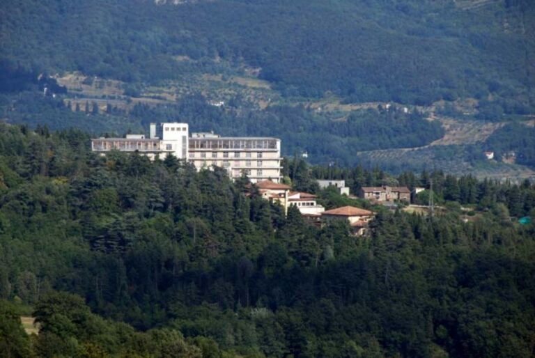
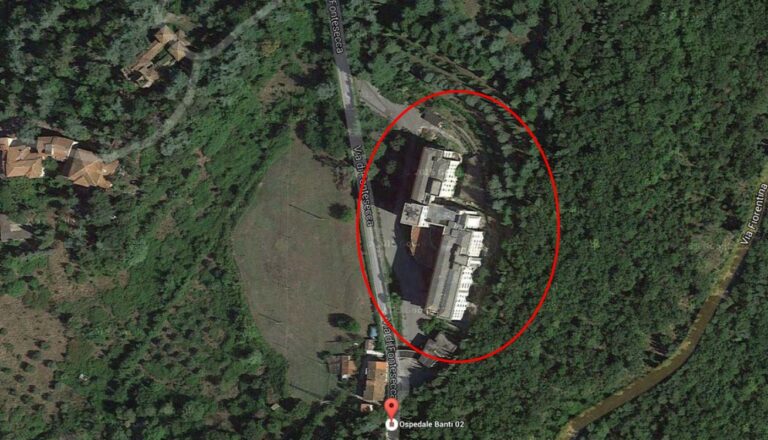
Located in a hilly area situated between 460 and 500 mt above sea level in Pratolino, Vaglia. The property is bordered on the west side by Via dell‘ Uccellatoio, which connects Via Bolognese with the road of the high hills, halfway up the mountain Morello, leading to Sesto Fiorentino. On the northern side the property is bordered by the wide meadows of Poggio Corega and to the east by a municipally owned forest close to the park of Villa Demidoff.
The complex is located around 8 km from Florence and is served by the public mean of transport.
The construction of the complex was decided in 1934 by the Provincial Administration of Florence with the purpose of creating a convalescent hospital for workers of both sexes; the location was chosen for the clean air, the richness of the woods and the distance from the city.
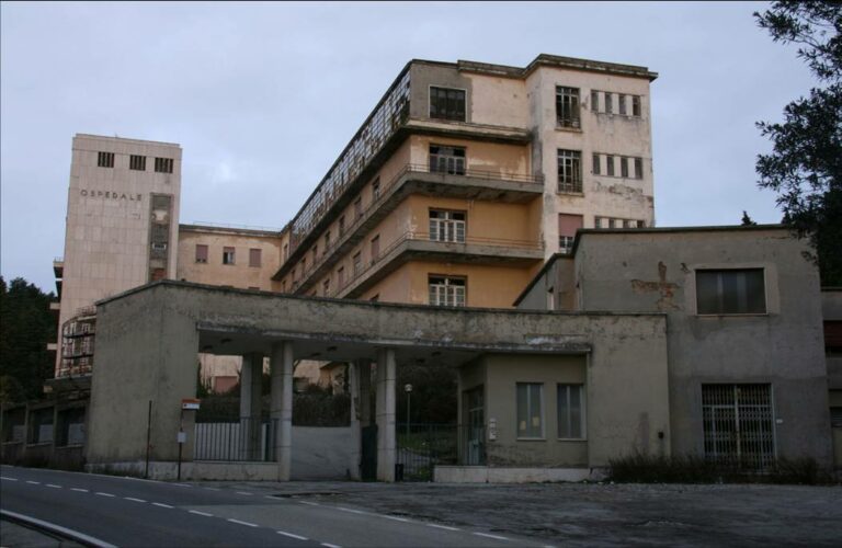
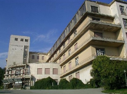
Construction, which was started in June 1934 by the Social Security Service, was finished with the creation of a sanatorium building in place of the expected convalescent hospital in autumn 1939. The sanatorium building and the entrance building intended for concierge service are among the first Italian buildings to be built in reinforced concrete and are characterised by soberly geometric shapes typical of rationalist architecture.
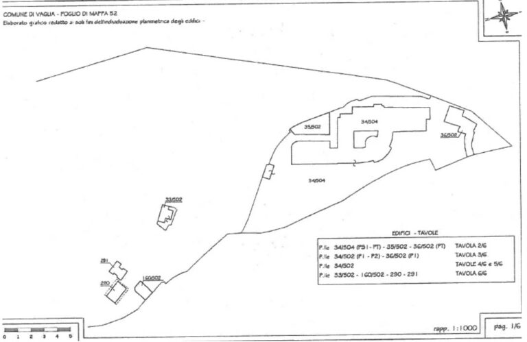
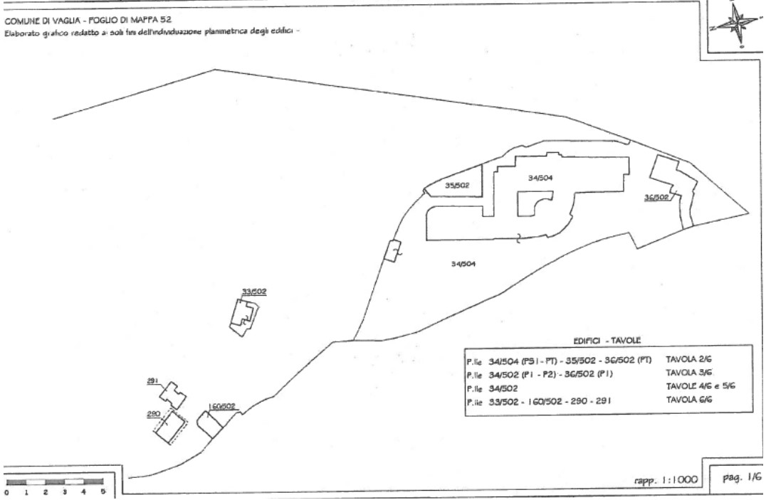
These buildings are concentrated in the south-west area of the property, towards Via dell‘ Uccellatoio, the remaining vast area was designed as a park, fitted with tree-lined terraces, pathways and parterres so that patients could stay outside and enjoy the benefits nature surrounding them. The abundance of balconies and windows that face onto the valleys and the stained glass windows were designed to provide light for sun therapy and evidence the desire to use the beneficial effects of the natural surroundings for therapeutic purposes.
Until 1967 all departments were operational. In 1970 the Social Security Service stopped managing the sanatorium and converted it to a hospital by the health service “G. Banti e Salviatino”; subsequently the complex was transferred to the town of Vaglia, bound to be used for health purposes in favour of Local Health Unit 10.
Having ended its function as a sanatorium, the building hosted hospital services until the 1st of February 1997 when the radiology service also ceased.
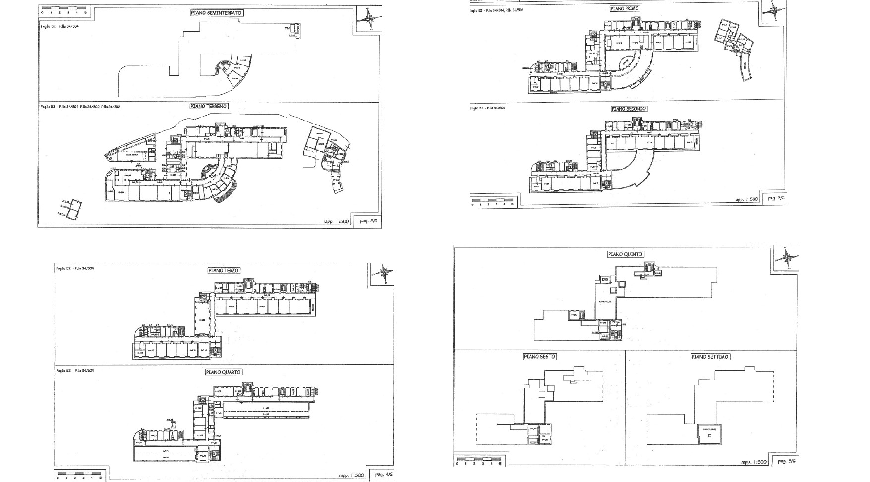
The main building – the former hospital – is arranged on five floors above ground, as well as a partial fifth floor and portion of basement, with a useful total gross area of around 12,000 sqm. It has a structured layout, resulting from the sum of two longitudinal buildings joined at the centre by a transverse wing. The prospects show the extreme compactness of the spaces that are connected around the central body of the main entrance and the tower of vertical connections.
The originally though use of space by the sanitary service was rationally organised. There were storage rooms in the basement, on the ground floor the porch opened onto the atrium which the offices, secretary and reception faced onto symmetrically. From here you could access the north and south wings along a wide central and longitudinal corridor that lead to the facilities, rooms and dorms. On the ground floor of the north wing, connected to the lobby via the stairs of the square room, there were the service rooms and laundry rooms, the south kitchens, refectory, storage and changing rooms for
staff. On the first floor the convex space of the entrance connected the north wing, where there were departments with five dorm rooms with services, and the south wing with the visiting rooms, the chapel and other department rooms. The second and third floors had the same distribution system with the addition of a large room used as a cinema with a projection room. On the fourth floor there were large sun therapy windowed rooms. The covering of the building is in part terrace and in part roofing.
Ownership
- Ownership Name: Local Health Unit
- Type: Public body
Location
- Province: Firenze
- Municipality: Vaglia
- Address: Via di Fontesecca, 219 - Vaglia (Città Metropolitana di Firenze)
Accessibility
- Airport: 10 km
- Railway Station: 11.2 km
- Motorway: 10 km
Info
- Gross Floor Area: 13,150 sqm
- Land Area: 43,000 sqm
Sectors
- Current Use: Hospitality, Residential, Social Housing, Student House
- Potential use: Hospitality, Medical/Assisted Living
Project details
-
Cadastral Docs:
-
Investment
- Type of Investiment: Sale of full ownership
- Intervention: Renovation and Restoration